- Home
- About Us
- Services
- Subdivision
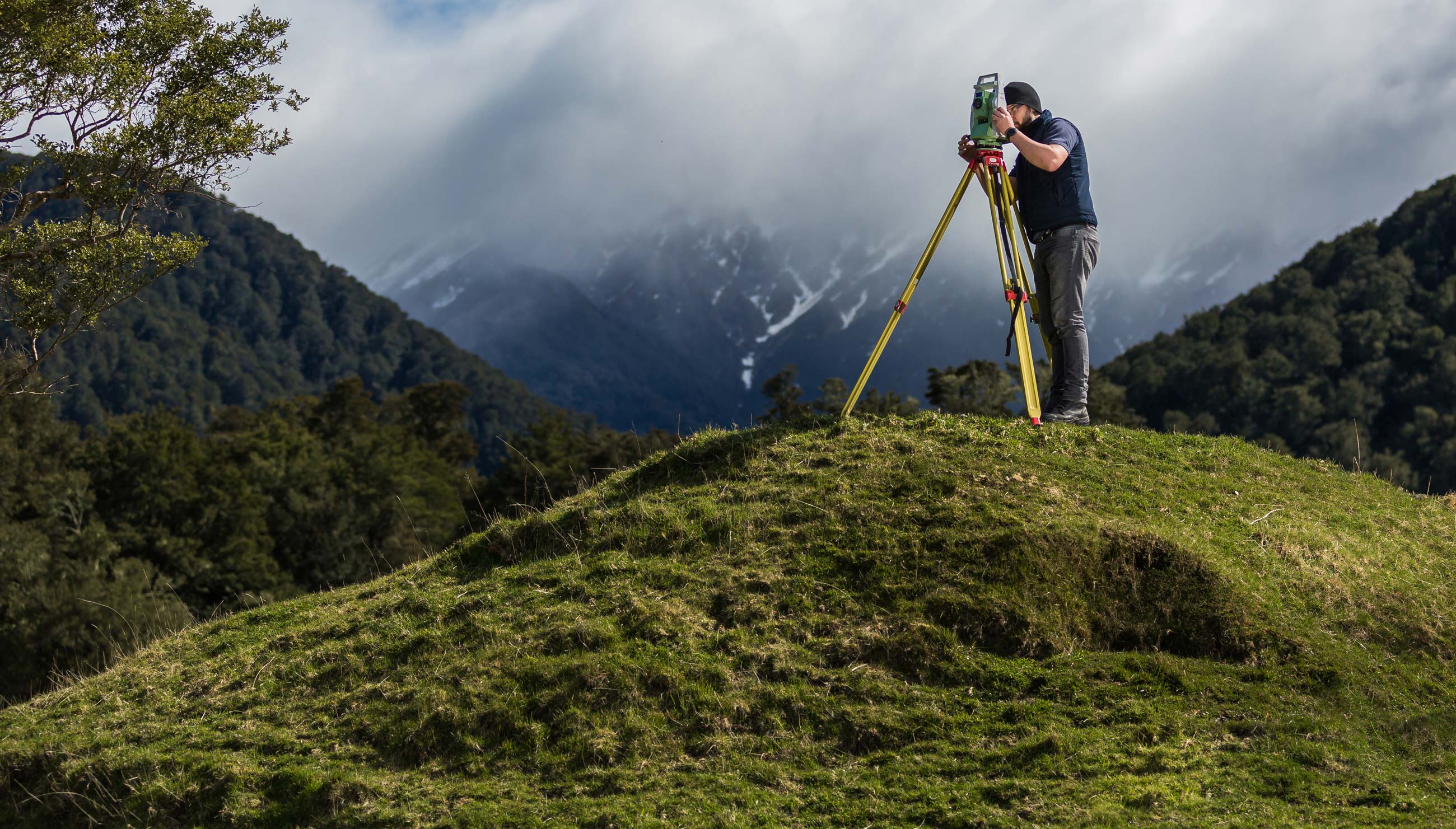
- Land Surveying
- Farm Mapping
- Computer Drafting
- Civil Engineering
- Resource Consent Application
- Aerial survey and mapping
- 3D Laser Scanning
Aerobotics provides actionable insights into the health of the orchards of farmers across the world. Their technology combines high-resolution aerial imagery and expert-trained artificial intelligence.
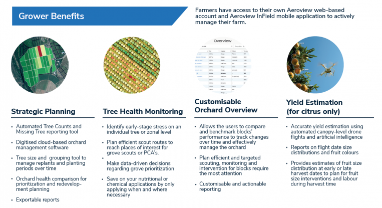
Aerobotics’ web-based platform together with its mobile app, Aeroview InField, provides farmers with an end-to-end farm management system for keeping track of farm health and interventions. After a drone flight that captures high-resolution images of an orchard or vineyard, farmers have access to per-tree and zone analytics. This includes health, canopy size, tree counts, areas that show potential risks and alerts for early-stage stress. From here, farmers can set up a scout route on Aeroview with the problem areas marked. Scouts then follow this route with Aeroview InField open on their mobile phones, which directs them to each marker where they can leave notes and take pictures to be analysed on Aeroview. This allows farmers to make data-driven farming decisions on where and when to take action, saving them time and money in the field.
Find out more by contacting us for a consultation, or by downloading our orchard analytics brochure here.
Promises are just words unless they’re solidly backed up. We back up this promise with the guarantee that you will get your land surveying job or subdivision completed on time and to budget or you’ll get it for free.
Excellent, efficient and friendly service all through, making our subdivision process very straightforward. We can thoroughly recommend The Surveying Company
HIGHLY RECOMMENDED! Had a great experience with Seamus, made my subdivision process very smooth and simple. Very professional service and very easy to deal with. Also helped me get an exemption from the $12K contribution payment to Hastings Council!I'm a very satisfied customer!
Nick was a great help and support throughout the subdivision process. Always quick to respond to calls and collaborated well to chase up subcontractors with me as required. Would thoroughly recommend Nick and the team at The Surveying Company to any future potential clients.
Excellent
Fast, efficient and reliable. Delivered what they proposed.
From start to finish, Nick was amazing to deal with, he talked a language that I could understand, he was very professional while being very user-friendly. I would strongly recommend him to anyone wanting to subdivide. I'd like to take the opportunity to thank him for all the help he gave throughout the process, thank you Nick, you made the process very easy for us.
Regards, John
Thank you The Surveying Company, this was my first time doing a subdivision and you made it super easy. Found you easy to contact and you always made prompt responses to my queries. I would recommend you guys to others. A very seamless process from my end. Raewyn
We are very happy with the service provided by all of the people we have dealt with at The Surveying Company, thank you.
Nick Wakefield did a great job through a difficult time with COVID and everything that went with it. There were many delays with the project outside of Nick's control. A project that should have taken months took years, but Nick continued to steer the project and followed up when he could.
The level of service and expertise we received during our land subdivision using Nick and The Surveying Company was outstanding. Nick was always prompt, responsive to our many queries and fully supportive for us throughout the whole process. I would recommend Nick and The Surveying Company to anyone seeking this type of expertise and advice.
The Survey Company H.B. recently completed a subdivision of our property.
The exercise was both a pleasant and positive experience with their approach always professional - relatable, open and obliging and
communications, timely and comprehensive.
Their service commitments are excellent.
From the outset Nick and staff were very approachable and professional. The process of subdividing was clearly explained and all costs laid out before starting so there were no surprises. We really appreciated Nick's patient answering of all our questions and extra advice when we also decided to add in easements for power. The surveying staff were friendly and respectful when on site and we would have no hesitation in recommending The Surveying Company to others. Many thanks to Nick and team.